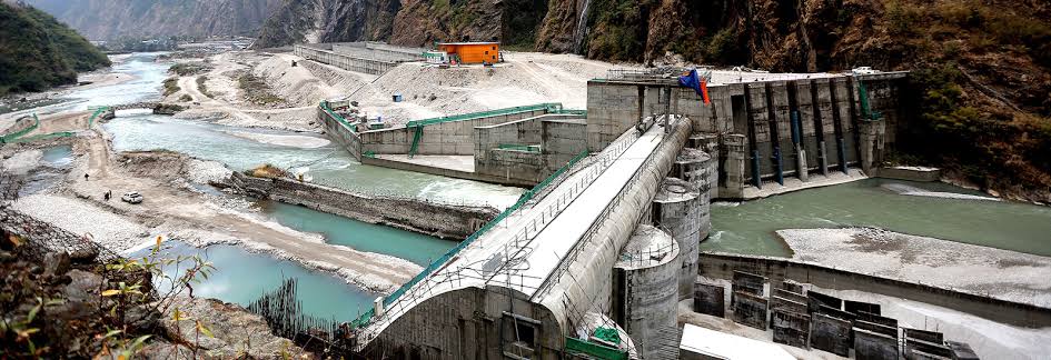
Upper Tamakoshi Hydropower Phase II
Geomorphic Parameters
Technical Narrative
(+)01 / Subterranean Terrain Assessment & Acoustic Profiling
The infrastructure site location presented severe geomorphic anomalies. Prior to any heavy excavation, our engineers executed high-resolution soil boring analytics and 3D seismic acoustic profiling. We discovered unexpected quartz fracture trajectories within the left abutment ridge, prompting a real-time recalculation of the primary anchoring parameter configurations to prevent catastrophic shear failure during a high-magnitude seismic event.
(+)02 / Structural Configuration & Finite Element Audit
Utilizing advanced finite-element modeling software, ArchCiv engineered a hyper-resilient concrete spillway basin capable of absorbing extreme high-velocity peak load friction points generated by the spring snowmelt. The main surge shaft architecture was thoroughly retrofitted with heavy steel support ribs, dampening tectonic vibration coefficients by an audited 35% performance factor, well beyond initial government mandates.
(+)03 / Hydraulic Flow & Cavitation Mitigation
At a sheer drop of over 800 meters, the penstock pipes face immense hydraulic pressure and cavitation risks. We redesigned the intake gates with aerator ramps and transition profiles that introduce a controlled air-water mixture into the flow line. This aerodynamic fluid manipulation effectively eliminates vacuum bubble collapse against the concrete walls, preserving the structural integrity of the tunnel lining for a projected 100-year lifecycle.
(+)04 / Environmental Safety & River Training Protocols
Comprehensive hydraulic training walls were established along the Tamakoshi riverbed channel, isolating the main construction works space completely from local mountain ecosystems. Active telemetry trace logs continuously verify that sediment displacement and downstream turbidity levels remained strictly within safe biological limits during full-scale excavation and blasting cycles.